Flood zone map of Spain
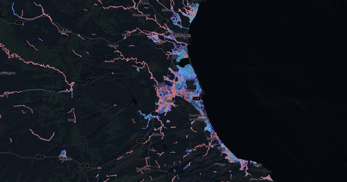
The environment ministry's national flood mapping system (SNCZI) draws how far water reaches in the 10-, 100- and 500-year floods.
What each zone means
- Preferential flow zone(zona de flujo preferente): where flood water runs strongly. On rustic land, new homes are generally not allowed (RDPH, art. 9 bis).
- 100 years: a 1% chance each year. The reference for insurance and permits.
- 500 years: rare, but possible: look at where the house would stand.
Only studied rivers are mapped. Dry gullies (ramblas, barrancos) can flood without showing: look at them on site.
Towns with the most flood zone
Towns of 10 km² or more, by the share of their area in the 500-year zone.
| Town | Province | 500-year zone | Preferential flow |
|---|---|---|---|
| Sant Jaume d'Enveja | Tarragona | 98.8 % | 71.4 % |
| Sant Pere Pescador | Girona | 93.2 % | 20.4 % |
| Dolores | Alicante/Alacant | 90.9 % | — |
| Deltebre | Tarragona | 90.8 % | 55.4 % |
| La Algaba | Sevilla | 90.8 % | 51.9 % |
| Pastriz | Zaragoza | 90.4 % | 58.8 % |
| Albalat de la Ribera | Valencia/València | 89.3 % | 4 % |
| Alfafar | Valencia/València | 82.9 % | 8.6 % |
| Puebla de la Calzada | Badajoz | 82.8 % | 19.1 % |
| Bellcaire d'Empordà | Girona | 80.8 % | 10.3 % |
| Mansilla Mayor | León | 78.9 % | 11.9 % |
| Algemesí | Valencia/València | 78 % | 24 % |
| Sobradiel | Zaragoza | 75.6 % | 55.6 % |
| Fuente Vaqueros | Granada | 74.1 % | 6.5 % |
| Novillas | Zaragoza | 74 % | 52 % |
The town finder filters those under 5% flood zone. Before buying, the checklist puts floods in their place.
Source: SNCZI, Ministerio para la Transición Ecológica y el Reto Demográfico.