Wildfire map of Spain since 2016
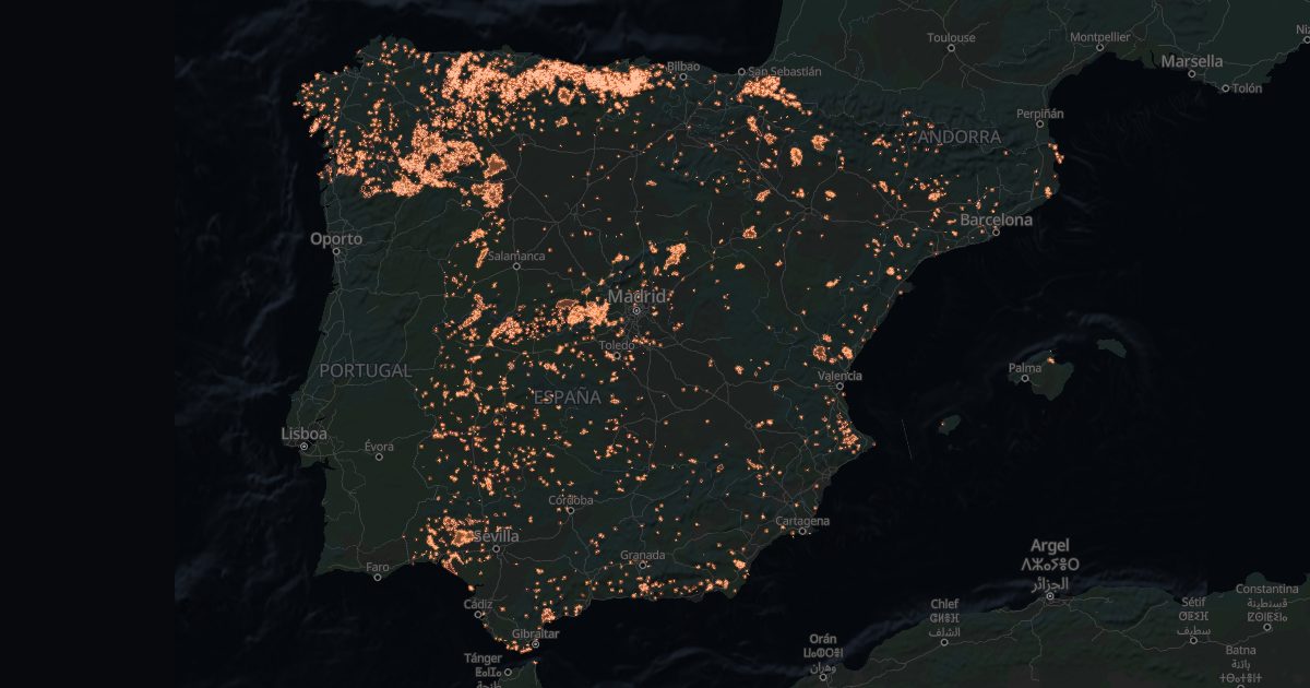
The European Forest Fire Information System (EFFIS) maps every fire of about 30 ha or more. Since 2016 they have touched 2,486 Spanish towns.
Why it matters when buying
- Burnt forest land cannot change use for 30 years (Forest Act, Ley 43/2003, art. 50): it cannot be rezoned for building.
- Where it has burnt, it can burn again: woodland near the house, the access and water to defend it all count.
- Regions require cleared strips around homes in risk areas.
Towns with the most burnt area
Total area of the fires that touched the town since 2016 (one fire can cross several).
| Town | Province | Fires | Hectares |
|---|---|---|---|
| Carballeda de Valdeorras | Ourense | 13 | 78,058 |
| A Veiga | Ourense | 16 | 76,143 |
| San Juan de la Nava | Ávila | 5 | 69,233 |
| El Barraco | Ávila | 6 | 67,858 |
| Burgohondo | Ávila | 4 | 67,201 |
| Riofrío de Aliste | Zamora | 5 | 67,178 |
| Robledo de Chavela | Madrid | 4 | 63,528 |
| Tábara | Zamora | 4 | 63,255 |
| El Campillo | Huelva | 4 | 63,022 |
| San Martín de Valdeiglesias | Madrid | 4 | 62,432 |
| Navas del Rey | Madrid | 2 | 62,397 |
| Laza | Ourense | 16 | 61,680 |
| Ferreras de Abajo | Zamora | 5 | 61,122 |
| Zalamea la Real | Huelva | 6 | 60,898 |
| Melgar de Tera | Zamora | 3 | 60,586 |
The town finder filters towns with no mapped fire since 2016.
Source: EFFIS, European Commission Joint Research Centre.