Map of wells and boreholes in Spain
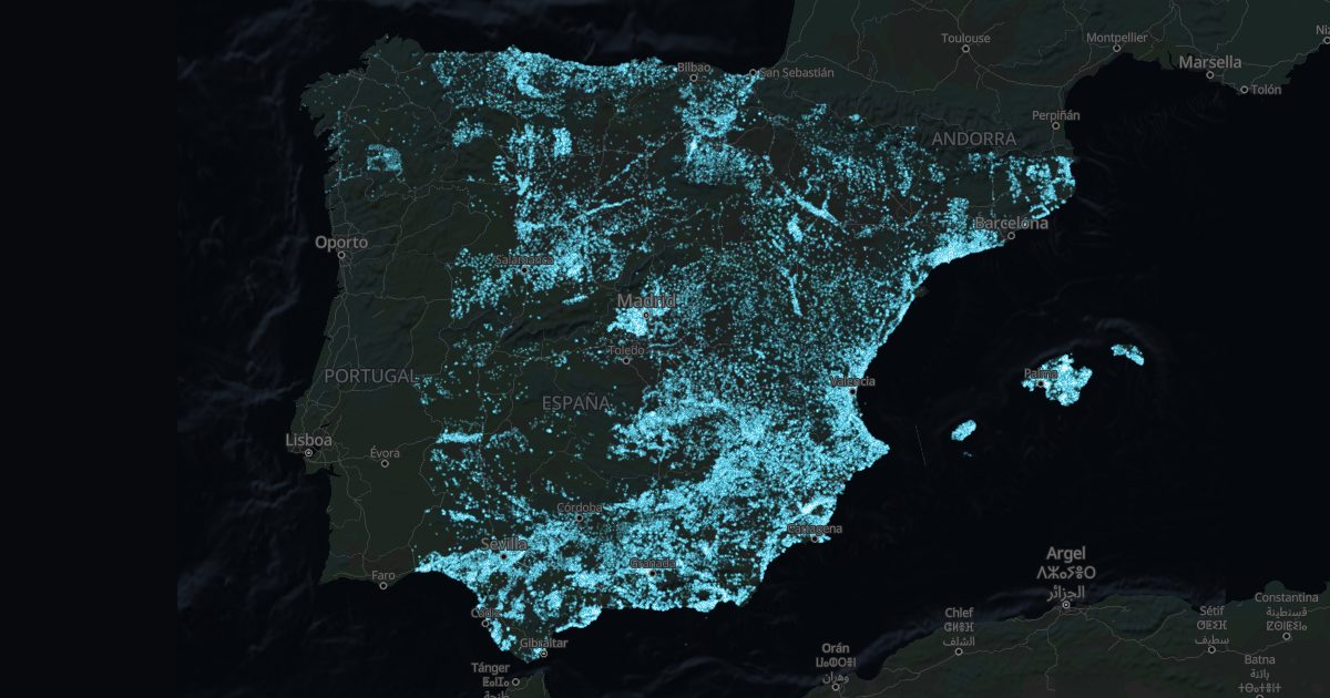
Spain's geological survey (IGME) records 110,296 wells and boreholes in its water database, many with their depth. It is the best public clue to whether there is water under a plot, and how deep.
What it shows, and what it does not
- Each point is a recorded work: a well, a borehole or a spring. The depth is the work's, not the water's.
- Many private wells are not recorded. No points is not proof of no water.
- What a well gives depends on the rock: see the aquifer map too.
Towns with the most recorded wells
| Town | Province | Wells and boreholes | Median depth |
|---|---|---|---|
| Murcia | Murcia | 2,860 | 20 m |
| Palma | Illes Balears | 1,851 | 15 m |
| Sa Pobla | Illes Balears | 1,765 | 12 m |
| Albacete | Albacete | 1,443 | 76 m |
| Muro | Illes Balears | 1,068 | 6 m |
| Campos | Illes Balears | 904 | 16 m |
| El Ejido | Almería | 769 | 68 m |
| Almonte | Huelva | 682 | 41 m |
| Orihuela | Alicante/Alacant | 651 | 18 m |
| Lorca | Murcia | 606 | 120 m |
| Carmona | Sevilla | 582 | 12 m |
| Almería | Almería | 580 | 24 m |
| Jumilla | Murcia | 569 | 29 m |
| Antequera | Málaga | 562 | 19 m |
| Cartagena | Murcia | 537 | 93 m |
Where wells are shallowest
Towns with at least 10 wells with a recorded depth, by median depth.
| Town | Province | Median depth | With a depth |
|---|---|---|---|
| Alba de Yeltes | Salamanca | 3 m | 13 |
| Almudévar | Huesca | 3 m | 10 |
| Castillejo de Martín Viejo | Salamanca | 3 m | 10 |
| Puerto Serrano | Cádiz | 3 m | 19 |
| Serradilla del Arroyo | Salamanca | 3 m | 10 |
| Torre Alháquime | Cádiz | 3 m | 19 |
| Villavieja de Yeltes | Salamanca | 3 m | 11 |
| Algeciras | Cádiz | 4 m | 91 |
| Almoradí | Alicante/Alacant | 4 m | 151 |
| Calzada del Coto | León | 4 m | 24 |
| Castrogonzalo | Zamora | 4 m | 17 |
| Cea | León | 4 m | 95 |
| Daya Nueva | Alicante/Alacant | 4 m | 27 |
| Dolores | Alicante/Alacant | 4 m | 34 |
| Espeja | Salamanca | 4 m | 18 |
To drill on your own land, the well guide explains the permits and the cost. The town finder filters by depth.
Source: IGME, Base de Datos de Aguas (BDAguas).