Map of aquifers in Spain
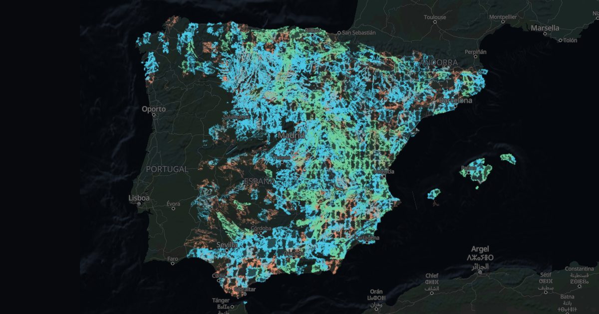
A well gives water if the rock holds it and lets it through. IGME's hydrogeological map (1:200,000) classifies all of Spain by just that.
The classes
- Porous (sands, gravels): water fills the gaps between grains. High or medium productivity: the best for a well.
- Karstic (limestones): water runs through cracks and caves. They can give a lot, but hitting it is harder.
- Low or local: pockets of water here and there; a well may give little.
- Impermeable: granites, slates, clays: little water, except in fractures.
A productive rock does not guarantee water under a given plot: a hydrogeologist decides that.
Towns over productive aquifers
Towns of 20 km² or more, by the share of their area over porous or karstic aquifers of high or medium productivity.
| Town | Province | Productive aquifer |
|---|---|---|
| Mosqueruela | Teruel | 100 % |
| Las Pedroñeras | Cuenca | 100 % |
| Campillo de Altobuey | Cuenca | 100 % |
| Fortanete | Teruel | 100 % |
| Roquetes | Tarragona | 100 % |
| Santa Cruz del Retamar | Toledo | 100 % |
| Vara de Rey | Cuenca | 100 % |
| Nava del Rey | Valladolid | 100 % |
| Topas | Salamanca | 100 % |
| Casas de Haro | Cuenca | 100 % |
| Madrigal de las Altas Torres | Ávila | 100 % |
| Alaejos | Valladolid | 100 % |
| Navalcarnero | Madrid | 100 % |
| Carboneras de Guadazaón | Cuenca | 100 % |
| Vinaròs | Castellón/Castelló | 100 % |
The town finder filters those mostly over productive aquifers. For one plot's water, the wells map shows what the neighbours found.
Source: IGME, Mapa Hidrogeológico de España 1:200,000.